
Hiking is an excellent way to exercise and gets you outside without the added risk of being around large groups of people. North Dakota has thousands of miles of hiking trails all across the state. At Rydell Honda of Grand Forks, we love to encourage locals and tourists to explore our beautiful region. If you’re looking to go on an adventure in northeast North Dakota, here are some of the best hiking trails in and around Grand Forks.
Greater Grand Forks Greenway
Located along the Red River of the North, the Greater Grand Forks Greenway features over 20 miles of walking and biking trails that are suitable for all activity levels. There is a 10 mile loop that takes you on both sides of the river, so you’ll be walking in both Grand Forks, North Dakota, and East Grand Forks, Minnesota. While you’re on the loop, you can link up with other trails in East Grand Forks, too.
The trail is accessible year-round and has seasonal activities available, including ice skating, sledding, golf, and swimming (not in the river). There are picnic areas, playgrounds, and campsites. You’ll also be treated to some great scenery along your walk, including views of the Flood Memorial, dike system, downtown, and more. Greater Grand Forks Greenway is also a dog-friendly trail, but your dog must remain on its leash at all times.
Agassiz Recreational Trail
Located southeast of Grand Forks, you’ll find the Agassiz Recreational Trail. The trail extends 52 miles, connecting the towns of Crookston, Ulen, Twin Valley, Gary, and Fertile. Agassiz Recreational Trail traverses several rivers and creeks, such as Mashaug Creek, Wild Rice and South Branch Wild Rice, and Sand Hill Rivers. There are also several recreational and wildlife areas you can explore from the trails. Depending on the time of year, you could hike, bike, or even go cross-country skiing. Other options include horseback riding, ATV riding, or snowmobiling.
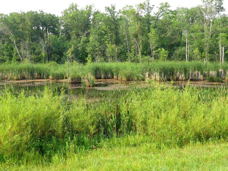
Turtle River State Park
Just west of Grand Forks, you’ll find the Turtle River State Park in Arvilla. Multiple trails are situated along the Turtle River in a lush wooded valley. The Civilian Conservation Corps built the park back in the 1930s. Today, you’ll find over ten miles of trails, a small waterfall, and a trout stocked river where you can practice some fly-fishing.
Choose from over ten different trails, ranging from the short 0.2 miles Woodchuck Trail to 2.53 miles hiking on Raven Ravine and Keystone Trails. You can download PDF maps of both the summer and winter trails on the Turtle River State Park website. Seasonal activities available at Turtle River State Park include cross-country skiing and sledding. You’ll also find picnic spots and camping sites if you want to make it an overnight getaway.
Lake Metigoshe State Park
If you’re headed to Turtle River State Park, you could include a stop at nearby Lake Metigoshe State Park. Here, you’ll find eight miles of trails and plenty of year-round activities. During the summer months, go swimming, boating, or fishing. When winter arrives, go sledding, ice fishing, cross-country skiing, or snowshoeing.
Lake Metigoshe has around 15 different trails you can explore. Some trails are available to hikers, while others are best to explore by snowmobile, canoe, or kayak. Trail lengths vary from just under one mile up to eight miles. Other park amenities include: four fishing docks, picnic shelters, boat ramp, dog park, sledding hill, swim beach, two playgrounds, and more.
North Country National Scenic Trail
Located south of Grand Forks is a portion of the North Country National Scenic Trail. This trail is one of the longest ones in the United States, spanning over 4,600 miles—more than twice the length of the famed Appalachian Trail. They have approved the trail for an expansion, where it will eventually connect with the Appalachian Trail in Vermont. There is an existing connection with the Lewis and Clark Trail, which begins in Oregon. Once the expansion is complete, you could walk from Oregon to Maine and then down to Georgia.
You have several options in Grand Forks to hike the North Country National Scenic Trail. You could drive about five hours west to Lake Sakakawea, which is where the trail ends, or you could head south and hike a portion of the trail around Sheyenne National Grassland. Don’t let the overall length of the trail intimidate you. It’s very easy to explore on a day hike or even an afternoon lunchtime stroll.
The Sheyenne section of the trail is one of the more popular hiking spots. It takes you through both plains and wooded areas. The trail also passes near Mineral Springs Waterfall, North Dakota’s only registered natural waterfall.
Sheyenne National Grassland
Sheyenne National Grassland is home to a portion of the North Country National Scenic Trail, and several other trails that are good for day hikes. Sheyenne is the only National Grassland in the tallgrass prairie region of the country. Many species of birds call the area home, and unique plants, including the western prairie fringed orchid. The U.S. Fish and Wildlife Service declared this type of orchid as a threatened species.
Day hike options include the Hankinson Hills Trail, North Country National Scenic Trail, and Oak Leaf Trail. Hankinson Hills Trail is an eight-mile loop and is only open to nonmotorized travel. Oak Leaf is a four-mile loop that connects with the northeast portion of the North Country National Scenic Trail. Like Hankinson Hill Trail, they do not allow motorized vehicles on Oak Leaf Trail.
Before you drive all the way to Sheyenne or any of the other trails and parks, make sure they are open. With travel restrictions changing, some parks and trails may not be open when you plan to go.
Are There Any Great Hiking Trails That We Missed?
Have you been hiking around Grand Forks, North Dakota? Any other trails you highly recommend that we missed on our list? If so, please contact us at Rydell Honda of Grand Forks so we can add your favorites to our list.
Connect with us
